Remote Sensing Scientist and Technologist guide · 2026
Free Remote Sensing Scientist and Technologist Resume Templates and Examples
Free ATS-friendly Remote Sensing Scientist and Technologist resume templates, copy-paste ready resume content, and writing tips to help you pass screening and land interviews.
01 · Resume example
Remote Sensing Scientist and Technologist Resume Examples (3 Templates to Choose From)
Three different resume styles for remote sensing scientists and technologists — classic, sidebar, and minimal. Each is tailored to real job requirements and ready to download. Pick the one that fits your experience level and personal style.
Resume Example · Classic
Dr. Katherine Liu
Remote Sensing Scientist
dr..katherine.liu@email.com | (555) 000-0000 | City, State, United States
Profile
Remote Sensing Scientist with 8+ years of experience in satellite image analysis, geospatial machine learning, and environmental monitoring. Published 12+ peer-reviewed papers on land cover change detection.
Work Experience
2019-Present · Senior Remote Sensing Scientist, GeoAnalytics Inc., Washington DC
Developed deep learning models for land cover classification achieving 97% accuracy across 10+ land cover classes.
Led a 5-person team analyzing 100TB+ of Sentinel-2 and Landsat imagery for deforestation monitoring.
Built automated processing pipeline reducing data processing time from 2 weeks to 2 days.
2014-2019 · Remote Sensing Analyst, NASA Goddard, Greenbelt
Analyzed MODIS and VIIRS satellite data for global vegetation health monitoring.
Published 6 journal articles on remote sensing of forest disturbance and recovery.
Education
Ph.D. in Geography (Remote Sensing), University of Maryland (2014); M.S. in Environmental Science, Duke (2010)
Skills
Hard skills: ENVI, ArcGIS, QGIS, Python (GDAL, Rasterio, scikit-learn), TensorFlow, MATLAB, LiDAR, SAR, Sentinel/Landsat Processing, Google Earth Engine
Dr. Katherine Liu
Remote Sensing Scientist
dr..katherine.liu@email.com | (555) 000-0000 | City, State, United States

PROFILE
Remote Sensing Scientist with 8+ years of experience in satellite image analysis, geospatial machine learning, and environmental monitoring. Published 12+ peer-reviewed papers on land cover change detection.

WORK EXPERIENCE
2019-Present · Senior Remote Sensing Scientist, GeoAnalytics Inc., Washington DC
- Developed deep learning models for land cover classification achieving 97% accuracy across 10+ land cover classes.
- Led a 5-person team analyzing 100TB+ of Sentinel-2 and Landsat imagery for deforestation monitoring.
- Built automated processing pipeline reducing data processing time from 2 weeks to 2 days.
2014-2019 · Remote Sensing Analyst, NASA Goddard, Greenbelt
- Analyzed MODIS and VIIRS satellite data for global vegetation health monitoring.
- Published 6 journal articles on remote sensing of forest disturbance and recovery.

EDUCATION
Ph.D. in Geography (Remote Sensing), University of Maryland (2014); M.S. in Environmental Science, Duke (2010)

SKILLS
Hard skills: ENVI, ArcGIS, QGIS, Python (GDAL, Rasterio, scikit-learn), TensorFlow, MATLAB, LiDAR, SAR, Sentinel/Landsat Processing, Google Earth Engine
Soft skills: Analytical Thinking, Research Methodology, Problem-Solving, Communication, Collaboration, Mentoring, Critical Thinking
Resume Example · Sidebar
Profile
Remote Sensing Technologist with 6+ years of experience applying geospatial data to solve problems in natural resource management and urban planning. Skilled in satellite imagery processing and geospatial analysis.
Managed geospatial database of 50TB+ satellite imagery and LiDAR data.
Produced land use/land cover maps for state-wide conservation planning.
Alex Thompson
Remote Sensing Technologist
alex.thompson@email.com | (555) 000-0000 | City, State, United States

PROFILE
Remote Sensing Technologist with 6+ years of experience applying geospatial data to solve problems in natural resource management and urban planning. Skilled in satellite imagery processing and geospatial analysis.

WORK EXPERIENCE
2020-Present · Remote Sensing Technologist, EarthWatch Corp, Denver
- Processed and analyzed satellite imagery for 20+ environmental monitoring projects using ENVI and Python.
- Developed automated change detection algorithms, reducing analysis time by 60%.
- Created interactive dashboards in ArcGIS Online for client stakeholders.
2017-2020 · GIS Analyst, Natural Resources Agency, Denver
- Managed geospatial database of 50TB+ satellite imagery and LiDAR data.
- Produced land use/land cover maps for state-wide conservation planning.

EDUCATION
M.S. in Geospatial Science, University of Colorado Denver (2017); B.A. in Geography, CU Boulder (2014); GISP certified

SKILLS
Hard skills: ENVI, ArcGIS Pro, QGIS, Python (GDAL, Rasterio), Google Earth Engine, LiDAR Processing, Sentinel/Landsat, Photogrammetry, PostGIS
Soft skills: Analytical Thinking, Problem-Solving, Communication, Adaptability, Collaboration, Detail Orientation, Project Management
Resume Example · Minimal
Maria Santos
Remote Sensing Scientist
maria.santos@email.com | (555) 000-0000 | City, State, United States
Professional Summary
Remote Sensing Scientist with 3+ years of experience analyzing satellite and aerial imagery for environmental and urban applications. Passionate about using geospatial data for sustainability.
Maria Santos
Remote Sensing Scientist
maria.santos@email.com | (555) 000-0000 | City, State, United States

PROFILE
Remote Sensing Scientist with 3+ years of experience analyzing satellite and aerial imagery for environmental and urban applications. Passionate about using geospatial data for sustainability.

WORK EXPERIENCE
2022-Present · Remote Sensing Scientist, GeoGreen, Austin
- Processed Sentinel-2 and Landsat imagery for urban vegetation mapping using Python and ENVI.
- Developed a machine learning pipeline for crop type classification with 92% accuracy.
- Created visualizations and reports for clients in agriculture and conservation sectors.
2020-2022 · GIS Technician, City Planning Department, Austin
- Produced land cover maps for city-wide sustainability planning initiatives.
- Managed LiDAR data processing for flood risk assessment.

EDUCATION
M.S. in Geographic Information Science, University of Texas at Austin (2022); B.S. in Environmental Science, UT Austin (2018)

SKILLS
Hard skills: ENVI, ArcGIS, QGIS, Python (GDAL, scikit-learn), Google Earth Engine, Sentinel/Landsat, LiDAR, Machine Learning, Geospatial Analysis
Soft skills: Analytical Thinking, Problem-Solving, Communication, Adaptability, Collaboration, Continuous Learning, Detail Orientation
02 · Free templates
Free Remote Sensing Scientist and Technologist Resume Templates (12 to Choose From)
Every template below is free, fully editable in WPS Writer, and formatted to pass ATS screening. Click a preview to view it full size, then download it and swap in your details.
Copy-Paste Resume Content for Remote Sensing Scientists and Technologists
A ready-to-use resume that matches what hiring managers and ATS screeners actually look for in a remote sensing scientist and technologist. Copy each section below into a WPS resume template, then tailor the numbers to your own experience.
Professional Summary
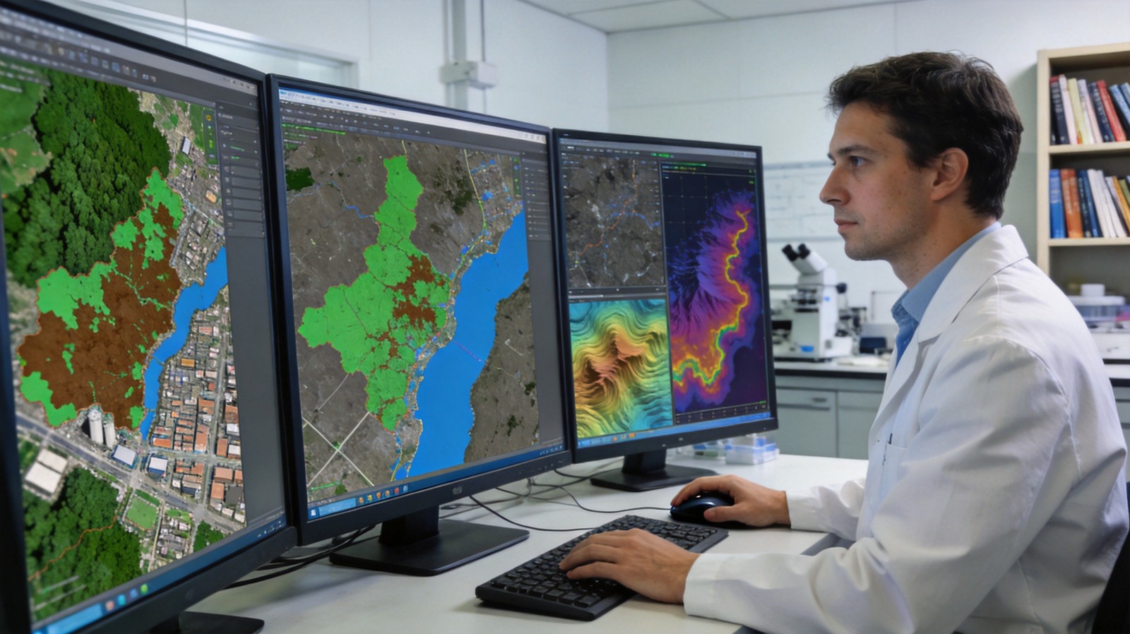
Remote sensing scientist analyzing satellite imagery and geospatial data on large monitors in a modern lab
Key Skills
Remote Sensing Software (ENVI, ERDAS Imagine, QGIS, ArcGIS), Satellite Image Processing, Spectral Analysis, Python/R for Geospatial, MATLAB, Geographical Information Systems (GIS), LiDAR Data Processing, Photogrammetry, Radar (SAR, InSAR), Geospatial Databases (PostGIS), Machine Learning for Remote Sensing
Work Experience (use action + result)
Remote Sensing Scientist at your current or most recent role: Analyzed multispectral and hyperspectral satellite imagery for environmental monitoring applications. Processed and classified satellite images using ENVI and Python, achieving 95% classification accuracy. Developed machine learning models for land cover classification and change detection. Managed geospatial databases with 50TB+ of satellite and aerial imagery. Prepared technical reports and visualizations for government and research stakeholders.
Education & Certifications
Master's or PhD degree in Remote Sensing, Geography, Environmental Science, or related field
These bullets are based on real remote sensing scientist and technologist job requirements — the duties, skills, and what employers actually screen for. Paste them into a free WPS ATS-friendly resume template, then adjust the numbers to match your own results.
04 · How to write
How to Write a Remote Sensing Scientist and Technologist Resume
Hiring managers look for proof of technical competency and measurable impact. Here is the step-by-step structure that gets your resume read — based on what real job postings ask for.
1
Open with Data Types and Applications
Start with the types of remote sensing data and applications. Example: 'Remote Sensing Scientist with 8+ years processing Sentinel-2, Landsat, and MODIS imagery for environmental monitoring and land cover classification.'
Keep it to one page unless you have 10+ years of experience. A clean, ATS-friendly layout in a free WPS template makes every section easy to scan.
05 · Common mistakes
Common Remote Sensing Scientist and Technologist Resume Mistakes to Avoid
Most applicants for remote sensing scientists and technologists make the same avoidable resume mistakes. Here is how to avoid them — so your resume passes ATS screening and gets read.
Not specifying satellite imagery sources
Sentinel, Landsat, MODIS, VIIRS, WorldView — list specific satellite platforms. Generic 'satellite imagery' doesn't demonstrate depth.
Omitting software proficiency
ENVI, ArcGIS, QGIS, ERDAS Imagine, Google Earth Engine — list specific tools with your proficiency level.
No mention of programming skills
Python (GDAL, Rasterio, scikit-learn), R, MATLAB are increasingly expected. Mention libraries and specific techniques.
Neglecting validation and accuracy metrics
Classification accuracy, RMSE, Kappa coefficient — include validation metrics that demonstrate the quality of your analysis.
Missing publications or research contributions
If you've published research, present it prominently. Journal articles, conference papers, and technical reports establish credibility.
06 · Why WPS
Build a Professional Resume with WPS Office
Hundreds of free, ATS-friendly resume templates — start from a polished layout, not a blank page. Built-in spell & grammar check catches typos that can get your resume screened out. One-click PDF export keeps your…
From a ready-made ATS-friendly template to a polished PDF, WPS Office covers the whole resume-writing process — free, lightweight, and no subscription needed.
1
Start with a Free ATS-Friendly Template
Choose from 1,000+ professionally designed resume templates for every industry and career stage. Clean, parseable layouts that pass applicant tracking systems — so your application actually gets seen by a human.
2
Edit Freely in WPS Writer
Easily change text, fonts, and colors in a lightweight, fully-featured Word editor. Tailor every line to the job you want — no subscription, no watermark, your style.
3
Polish with Built-in Tools
Use the built-in spell and grammar checker to catch typos, and keep headers, spacing, and bullets clean so your resume stays scannable and professional.
4
Export to PDF with One Click
Convert your finished resume to PDF with zero formatting shifts, so it looks perfect on any recruiter's screen — ready to send in seconds.
Write Your Remote Sensing Scientist and Technologist Resume with WPS Office — Free
Free Word editor, PDF converter, and 1,000+ resume templates. No sign-up required.
Quick answers for aspiring remote sensing scientists and technologists and career changers evaluating the role.
A Remote Sensing Scientist analyzes satellite and aerial imagery to solve problems in environmental monitoring, urban planning, agriculture, and natural resource management. They process imagery, develop algorithms, and create geospatial products.
Key tools include ENVI, ArcGIS, QGIS, Google Earth Engine, Python (GDAL, Rasterio, scikit-learn), MATLAB, and specialized software for LiDAR and SAR processing.
Scientists typically focus on research, algorithm development, and publishing, while Technologists focus on operational processing, data management, and applied projects.
Salaries range from $75,000 to $130,000, with senior scientists and those with PhDs earning $140,000+.
A Master's degree is typically the minimum for scientist roles. PhD is expected for research-intensive positions and academic roles.
Start Your Remote Sensing Scientist and Technologist Job Search
Get the complete WPS job-search kit: an ATS-friendly remote sensing scientist and technologist resume template, a skill checklist, and an interview tracker — all free. Build a resume that gets interviews, close your skill gaps, and walk into every round prepared.